

![]()
UAV Vision Media provides Vacant Land Photography & Drone Marketing Services across Wisconsin & Beyond:
 Awarded by Quality Business Awards #1 BEST RATED 2025 – Photographer in South St. Paul, MN
Featured by Peerspace Among the Best 9 Photographers in Minneapolis
…………………………………………………………………
Serving high-demand land and rural property markets across:
✔Hudson WI
✔New Richmond WI
✔Eau Claire WI
✔River Falls WI
✔Duluth, Twin Cities, Greater Wisconsin & Beyond
…………………………………………………………………
Looking for more than just land photos?
✔Explore full-service Real Estate Photography & Drone Videography
✔Visit our homepage for drone, development, construction, and commercial media services
…………………………………………………………………
Who This Service Is For & When You Need It
If you are thinking:
“I need drone photos for vacant land near me”
“I want to show acreage boundaries and build potential”
“I need aerial images for a rural property listing”
“I want professional land marketing content for buyers”
“I need utility, septic, and site-access visuals documented clearly”
“I want one company handling all land media professionally”
Built for:
FSBO land sellers
Rural acreage owners
Land investors and developers
Builders and contractors
Hunting and recreational property marketers
Commercial land and development projects
Pro Tip:
Vacant land listings with professional drone visuals generate significantly more buyer engagement than listings using basic ground photos.
…………………………………………………………………
Problems Without Professional Land Media
Dense trees hide property layout and access
Snow and vegetation reduce terrain visibility
Phone photos fail to show acreage scale
Buyers feel uncertain about build potential
No drone coverage = weak land presentation
Unclear utility access reduces buyer confidence
Impact:
Lower listing engagement
Reduced buyer trust
Longer time on market
Lower perceived development value
More unqualified inquiries
Pro Tip:
Most land buyers decide whether a property is worth exploring based on aerial visibility and perceived usability.
…………………………………………………………………
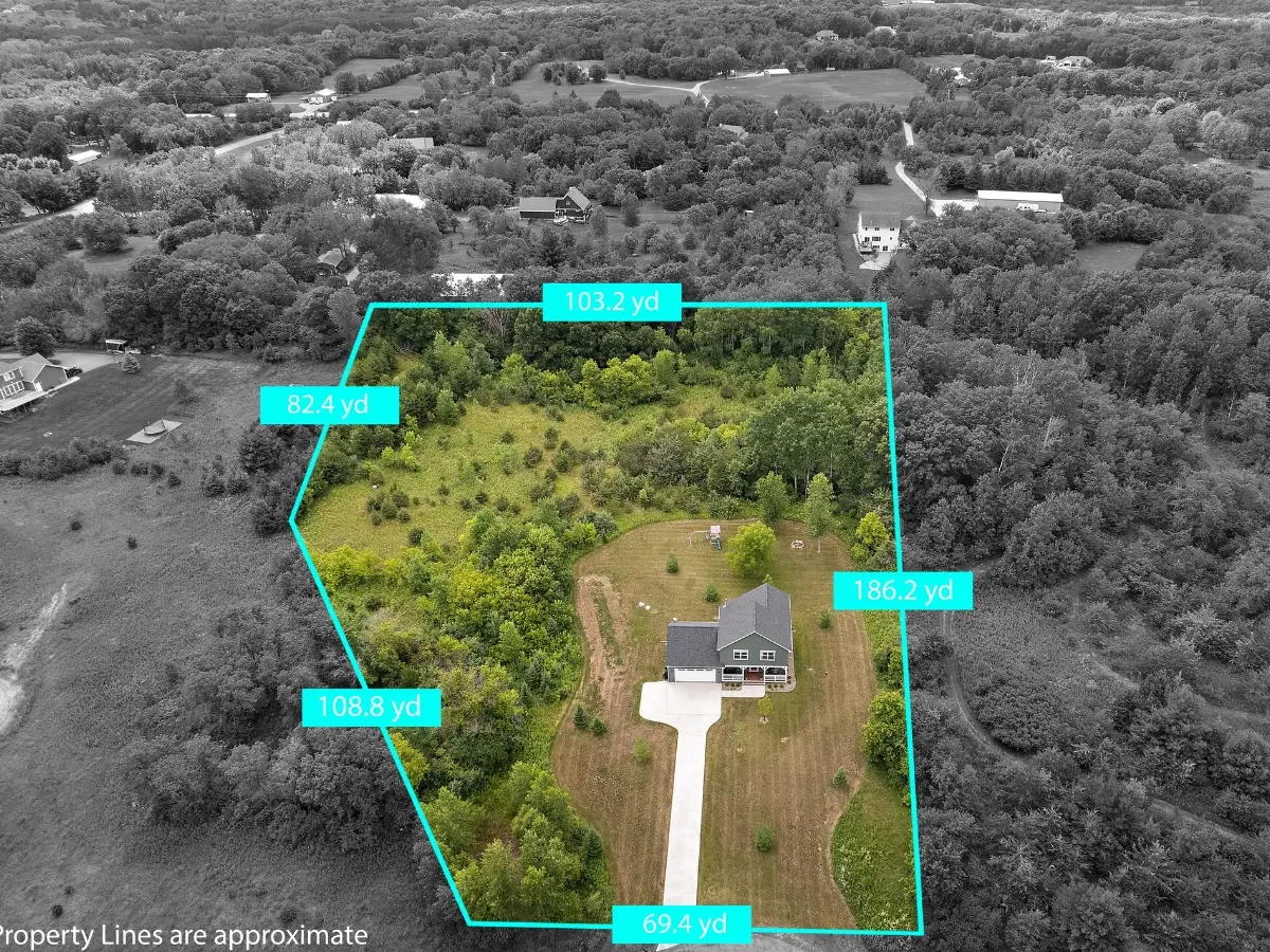
Vacant Land Photography & Drone Marketing (What Gets Captured)
We create high-impact aerial marketing visuals designed for land listings and development properties.
Coverage includes:
Drone aerial property overviews
Boundary and access road visuals
Build-site and terrain visibility imagery
Utility, septic, and electrical site documentation
Tree coverage and elevation visuals
Road frontage and neighboring area overviews
Development potential storytelling
Social media reels and listing clips
Result:
Higher buyer confidence
Better online visibility
Stronger perceived usability
Improved development presentation
More qualified land inquiries
Pro Tip:
Aerial before-and-after seasonal visuals help buyers better understand usable land potential year-round.
…………………………………………………………………
What You Get
Photography Services:
High-resolution drone property imagery
Ground-level access and road visuals
Development and build-site photos
Utility and infrastructure documentation
Videography Services:
Cinematic aerial flyovers
Property boundary walkthrough videos
Vertical reels for Facebook, Instagram, TikTok, and YouTube Shorts
Development and acreage storytelling clips
Add-On Services:
Seasonal property updates
Lot-line overlays and mapping visuals
Sunrise and sunset drone coverage
Multi-property investment portfolio coverage
Pro Tip:
Drone flyovers combined with lot overlays help buyers understand scale, access, and build opportunities faster.
…………………………………………………………………
Ongoing & Recurring Use Cases
FSBO vacant land listings
Acreage and hunting property marketing
Builder and developer site promotion
Subdivision and lot marketing
Commercial development land campaigns
Frequency:
Per listing / Seasonal / Quarterly / Development phases
Pro Tip:
Recurring aerial updates help developers and investors document land transformation professionally.
…………………………………………………………………
Wisconsin Land Market Factors
Dense vegetation limits visibility during warmer months
Snow changes terrain readability during winter
Rural access roads often need visual clarification
Large acreage properties require aerial perspective
Remote buyers rely heavily on drone visuals before visiting
Pro Tip:
Professional land drone media reduces buyer hesitation by clearly showing terrain, access, and development potential.
…………………………………………………………………
Why Choose UAV Vision Media
Experience with rural land and development marketing
FAA-compliant drone operations
Fast turnaround aligned with listing deadlines
Scalable aerial coverage for acreage and development projects
Optimized visuals for Zillow, LandWatch, Realtor.com, Facebook, and websites
Pro Tip:
Most land buyers search listings online first—your visuals must instantly show scale, usability, and accessibility.
…………………………………………………………………
Best Properties for This Service
Vacant rural acreage
Build-ready lots
Commercial development land
Hunting and recreational land
Lakefront and wooded parcels
Subdivision and investment properties
Pro Tip:
Large acreage and wooded properties benefit the most from professional aerial storytelling and seasonal drone visibility.
…………………………………………………………………
Local Expertise in Wisconsin Land Marketing
Understanding of rural property buyer psychology
Experience with wooded acreage and development visibility challenges
Knowledge of Wisconsin seasonal terrain and lighting conditions
Pro Tip:
Local expertise ensures visuals highlight exactly what land buyers, developers, and investors want to evaluate first.
…………………………………………………………………
Statewide & Nationwide Support
Available across Wisconsin & Beyond
Travel-ready for multi-property portfolios
Support for builders, investors, and developers
Flexible scheduling for regional and national land campaigns
Pro Tip:
Strong local authority combined with scalable drone production helps sellers market large land portfolios more professionally.
…………………………………………………………………
Trusted by Land Owners, Builders & Developers
Reliable and consistent quality
Helps sellers improve online visibility and buyer confidence
Proven results in engagement, land presentation, and marketing performance
Pro Tip:
Professional aerial land visuals increase perceived property usability and long-term investment appeal.
…………………………………………………………………