


![]()
Table of Contents
Elevating Property Listings with Drone Photography
Real estate drone photography has revolutionized the way properties are showcased in the modern world. It is a technique of capturing images and videos of properties from an elevated angle, providing a unique perspective to potential buyers.
Using drones to capture aerial footage of properties has become increasingly popular among real estate agents and sellers, due to its ability to showcase properties in a way that was previously impossible. With drone technology, it is now possible to capture stunning aerial views of properties, highlighting their unique features, location, and surroundings.
If you are a real estate agent or seller looking to utilize aerial and drone photography for your property listings, here’s a guide on how to do it effectively:
Hire a Professional Drone Photographer
While it may be tempting to purchase a drone and try to capture images and videos of your properties yourself, it is recommended to hire a professional drone photographer who has the necessary skills and equipment to capture high-quality footage. A professional drone photographer can ensure that the images and videos captured are of the highest quality and are able to showcase the property effectively.
Check Local Regulations
Before you start using drones for real estate photography, it is important to check your local regulations and laws regarding drone usage. Different areas may have different rules and regulations, so it’s important to check with the relevant authorities to ensure you are operating legally.
Determine Your Needs
Before you start capturing images and videos of the property, determine your needs and what you want to showcase. Do you want to highlight the property’s unique features, location, or surroundings? What type of footage would be most effective for your marketing efforts? Determining your needs ahead of time can help you to capture the footage that will be most effective.
Advantages of Aerial and Drone Photography in Real Estate
There are many advantages to using drone photography in real estate. Here are some of the benefits:
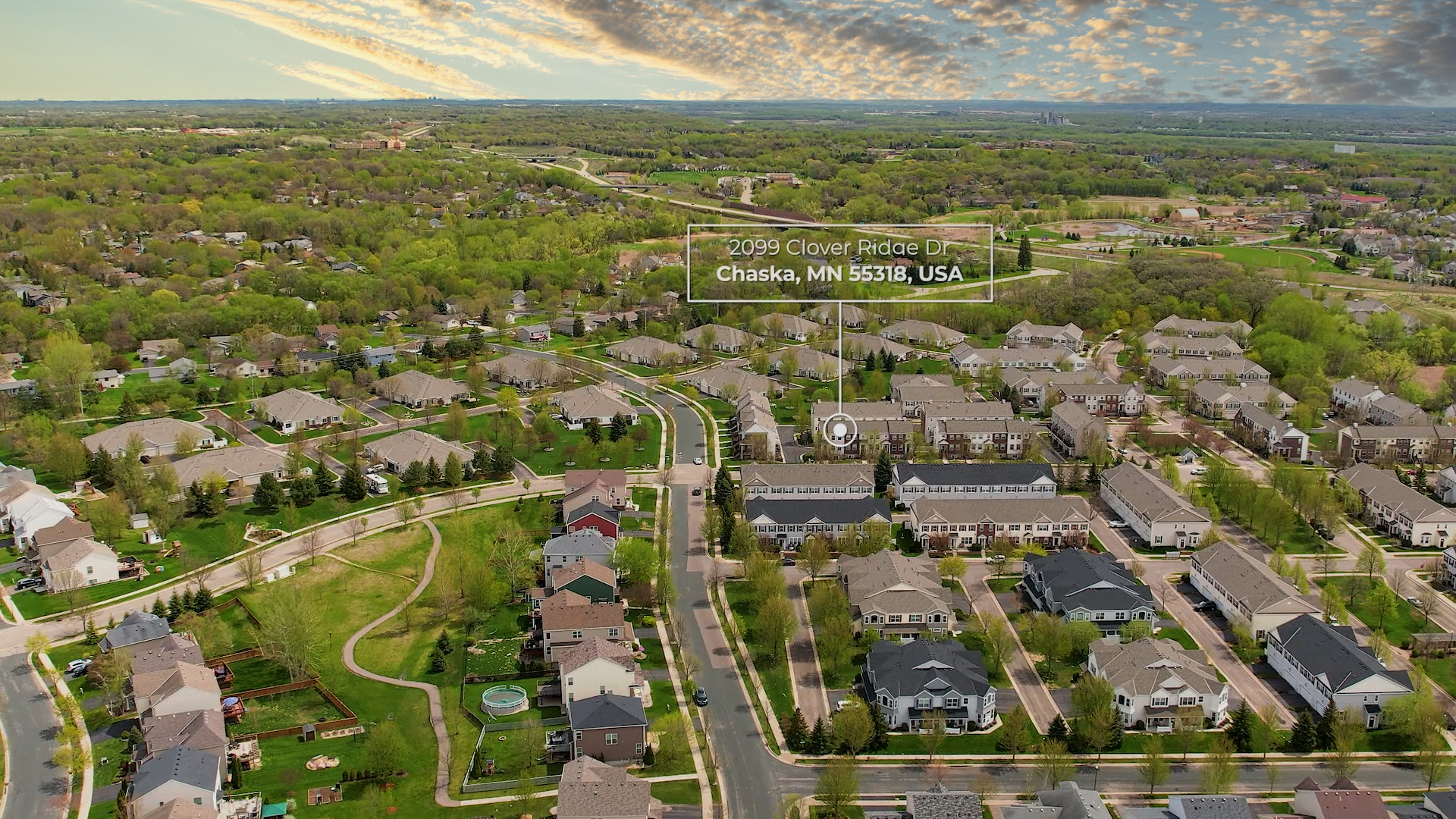
- Aerial photography can provide a unique perspective that showcases the property’s location and surroundings.
- It can capture the property’s size and scale from above, which is difficult to do with traditional photography.
- Aerial photography can highlight features such as pools, outdoor living areas, and expansive landscapes.
- It can be used to showcase the property’s proximity to amenities such as parks, beaches, and city centers.
- Aerial photography can help buyers visualize the property’s potential, especially for larger estates and commercial properties.
How To Get Started With Real Estate Drone Photography in Minnesota
- Study and Get Your Part 107 Drone License
- Purchase your Drone of Choice
- Make sure to purchase the needed accessories – cases, sd cards, gimbal cover, filters, ect.
- Purchase Insurance
- Register your aircraft with the FAA
- Purchase your Commercial Operations License
- Register your aircraft with MNDOT
- Go through your drone’s settings and make sure you understand what each control does
- Check the weather forecast and wind speed
- Look over and check the airspace before every flight
- If the flight location is in restricted airspace, you’ll need to file a LAANC Authorization Request
- Always be aware of your surroundings when you are flying
Tips For Taking Excellent Real Estate Drone Photos
- Tip #1: Stage The Yard Beforehand
- Tip #2: Plan For Traffic
- Tip #3: Plan For Weather & Light
- Tip #4: Pick Settings For Success
- Tip #5: Pack Your Supplies
- Tip #6: Know The Property & Pick A Focus
- Tip #7: Shoot For Variety
- Tip #8: Take Multiple Shots
- Tip #9: Enhance Photos In Post
- Changing The White Balance
- Reducing Highlights And Shadows
- Cropping For Aesthetics