


Stevens Point occupies a distinctive Central Wisconsin property environment where Wisconsin River geography, established residential neighborhoods, executive and custom homes, wooded properties, a major university campus and commercial real estate exist within a compact regional city surrounded by unusually strong natural corridors.
Unlike nearby communities whose property identity may be driven primarily by conventional residential development, rural acreage or one recreational amenity, Stevens Point combines approximately three miles of Wisconsin River frontage with an extensive green-space network woven directly into the community. The 27-mile Green Circle Trail encircles Stevens Point through river shores, forests, parks and wetlands and connects with more than 45 additional miles of trails. UW–Stevens Point contributes a 406-acre flagship campus, while the nearby 280-acre Schmeeckle Reserve and 24-acre Lake Joanis reinforce the city’s relationship with wooded landscapes and outdoor recreation.
Marketing property here therefore requires determining whether its strongest story comes from river context, architecture, wooded privacy, acreage, university-area positioning, investment functionality, commercial site characteristics or its relationship with Stevens Point’s broader regional environment.
…………………………………………………………………
Conventional property photography can effectively document bedrooms, kitchens, offices or commercial interiors while failing to communicate how an individual Stevens Point property fits within its surrounding land and regional geography.
A Wisconsin River-area residence may require buyers to understand actual water relationships, elevation, outdoor spaces and wooded surroundings. An executive or custom home creates a different visual requirement centered on architecture, premium interiors and landscape integration. Acreage and wooded properties introduce questions involving parcel configuration, privacy and access, while multifamily, investment and commercial assets require clear documentation of building scale, parking, circulation and site relationships.
A Stevens Point-specific approach combines professional HDR and architectural photography with FAA Part 107 aerial perspectives where appropriate, property-boundary highlighting, FPV walkthroughs, Matterport 3D Tours, floor plans, cinematic property films and regional-context imagery. Together, these assets can explain not simply the building, but how architecture, land, water, wooded surroundings and site configuration contribute to the complete property.
…………………………………………………………………
Every Stevens Point property receives a visual strategy designed around its actual relationship with the Wisconsin River, wooded landscape, lot configuration, university environment, natural corridors and regional-city setting rather than a generic Central Wisconsin real estate template.
✔ 20–200 professionally edited images can document complete interiors, exterior elevations, architectural features, residential living areas, multifamily spaces and commercial interiors according to the individual property type.
✔ Wisconsin River-context photography can document actual water views, river-area geography and meaningful property relationships where present without implying direct river frontage or private access that a listing does not provide.
✔ River-area home photography can deliberately connect relevant windows, decks, yards and outdoor spaces with the surrounding landscape, helping buyers understand how Wisconsin River geography contributes to the residence.
✔ 6–60 FAA Part 107 aerial photographs where appropriate can establish residence or building placement, lot configuration, wooded surroundings, driveways, parking, secondary structures and broader geographic context where airspace, flight conditions and regulations permit.
✔ River-corridor aerial storytelling can provide elevated perspectives of genuine property-to-river relationships where applicable, helping remote buyers understand geography that conventional ground-level images may not clearly communicate.
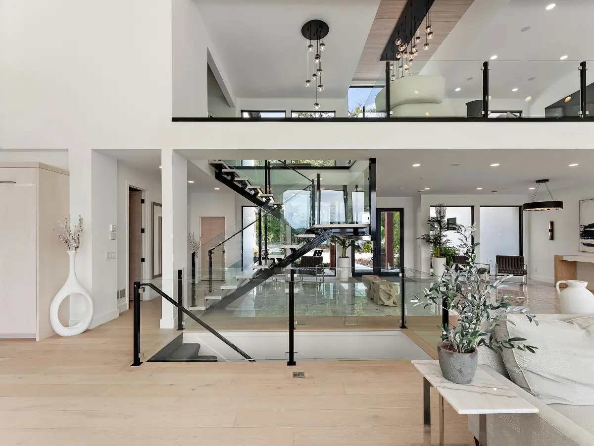
✔ Executive-home photography can emphasize architectural design, premium kitchens, larger living areas, home offices, custom finishes, landscaping and outdoor entertainment spaces while maintaining the Stevens Point context surrounding the residence.
✔ Custom-home architectural photography can give rooflines, exterior materials, windows, interior craftsmanship, specialty rooms and integrated design features dedicated attention rather than presenting architecturally distinctive properties through generic room coverage.
✔ Wooded-property photography can document mature tree coverage, natural screening, residence placement and landscape integration where privacy and forest character contribute materially to the listing.
✔ Property-boundary highlighting where appropriate can help buyers interpret acreage, wooded parcels and irregular lots whose complete scale may be difficult to understand from ground-level photography.
✔ Wooded-versus-open land visualization can distinguish yards, tree-covered areas, usable acreage, driveways and natural buffers, helping buyers evaluate how larger properties physically function.
✔ Acreage-property aerials can establish the relationship between the residence, land, access points, secondary structures and surrounding landscape rather than reducing a larger property to house-only imagery.
✔ Green Circle Trail context can be incorporated where geographically relevant, helping applicable listings communicate their relationship with Stevens Point’s 27-mile trail environment without implying direct access where none exists.
✔ Schmeeckle Reserve and natural-corridor context can support location storytelling for appropriately positioned properties while clearly distinguishing community proximity from direct adjacency or private access.
✔ UW–Stevens Point context can be incorporated where relevant for residential, multifamily, investment or commercial properties whose genuine geographic relationship with the 406-acre campus contributes to their positioning.
✔ Multifamily-property photography can document exterior architecture, representative interiors, common spaces, parking and site configuration while aerial imagery where appropriate establishes building relationships and surrounding density.
✔ Investment-property photography can combine building condition, interior functionality, site characteristics and neighborhood context to help remote investors evaluate the physical asset before scheduling an in-person visit.
✔ Commercial architectural photography can document façades, entrances, interiors, tenant spaces, signage areas, parking and site relationships according to how the individual Stevens Point property actually functions.
✔ Commercial site-context aerials can establish building footprint, parking, vehicle circulation, neighboring development and relevant transportation relationships where those characteristics contribute to the asset.
✔ Site-access photography can document entrances, driveways, parking approaches, loading areas where present and circulation patterns that may influence commercial or multifamily functionality.
✔ Neighborhood-context photography can document mature residential streets, landscaping, surrounding architecture and relevant nearby environmental features without substituting generalized city imagery for the individual property.
✔ Regional-accessibility storytelling can visually establish meaningful transportation and development relationships where relevant without relying on unsupported commute-time or proximity claims.
✔ 30–240 second cinematic property films can connect arrival, architecture, interiors, wooded surroundings, acreage, river context and relevant regional features into one cohesive Stevens Point property story.
✔ 15–60 second vertical reels can transform architectural details, Wisconsin River perspectives, wooded environments, aerial site views and distinctive property features into reusable assets for listing launches, social media and real estate professional branding.
✔ FPV walkthroughs can connect entrances, interior spaces, decks, yards, commercial areas and other relevant property zones, helping remote viewers understand physical flow beyond individual static images.
✔ Matterport 3D Tours and 2D & 3D Floor Plans help buyers, investors and commercial decision-makers evaluate room relationships, multi-level residences, multifamily layouts and larger interior spaces before traveling to Stevens Point.
✔ Twilight photography where appropriate can showcase executive homes, custom residences, multifamily buildings and architecturally distinctive commercial properties when exterior lighting and evening presentation contribute to the asset.
…………………………………………………………………
 Awarded by Quality Business Awards #1 BEST RATED 2025 – Photographer in South St. Paul, MN
Featured by Peerspace Among the Best 9 Photographers in Minneapolis
✔ Fully Insured FAA Part 107 Certified Drone Pilot
✔ One Appointment for Interior, Exterior, Architectural, Aerial, Acreage & Site-Context Coverage Where Appropriate
✔ No Image Limits — We Deliver Every Professionally Edited Photo Needed to Showcase the Complete Property
✔ River-Area Home, Executive Residence, Custom Home & Wooded Property Coverage
✔ Acreage, Multifamily, Investment & Commercial Property Photography
✔ Wisconsin River & River-Corridor Context Where Relevant
✔ Property Boundary, Wooded-Land & Lot-Scale Visualization Where Appropriate
✔ UW–Stevens Point & Regional Context Where Applicable
✔ Commercial Building, Parking, Access & Site-Relationship Photography
✔ FPV Residential & Commercial Property Walkthrough Capabilities
✔ Matterport 3D Tours & Floor Plan Documentation
✔ 24–48 Hour Photography Turnaround Where Applicable
✔ Serving Stevens Point, Portage County, Central Wisconsin, Minnesota & Beyond
…………………………………………………………………
A Stevens Point property should communicate more than interiors, square footage and basic location. UAV Vision Media creates property-specific visual marketing that helps real estate professionals, property owners, investors and commercial decision-makers show how Wisconsin River geography, architecture, wooded privacy, acreage, building scale, site configuration and the surrounding regional environment contribute to the complete property.
Professional HDR and architectural photography, FAA Part 107 aerial imagery where appropriate, property-boundary highlighting, river-corridor context, FPV walkthroughs, Matterport 3D Tours, floor plans and cinematic property films can then be selected according to what actually distinguishes the listing. The resulting presentation helps buyers and investors understand whether they are evaluating a Wisconsin River-area residence, wooded executive home, custom property, acreage parcel, multifamily asset or commercial building while preserving the distinctive Stevens Point relationship between the Wisconsin River, its university environment and a network of forests, wetlands, parks and trails integrated directly into the Central Wisconsin regional city.


