


Blue Earth County occupies an unusually diverse position within South-Central Minnesota real estate because its property market extends across approximately 764 square miles where the Minnesota River Valley, wooded bluff terrain, roughly 368 miles of rivers, lakes and streams, productive agricultural land, rural townships and the Greater Mankato regional center coexist within one county.
Unlike an individual city page where residential marketing can concentrate on one neighborhood structure or dominant housing type, Blue Earth County requires a much wider geographic perspective. An executive residence near the Greater Mankato core, a rural acreage home overlooking open land, a working farmstead surrounded by agricultural ground, a wooded property near river-valley terrain and a multi-structure parcel can all require completely different visual explanations.
Greater Mankato adds another defining layer because it functions as the principal regional marketplace spanning Blue Earth and Nicollet counties. Properties can therefore combine rural privacy, agricultural scale or small-community living with practical access to a larger employment, commercial and service center.
Marketing Blue Earth County property should consequently explain whether the listing’s strongest value comes from architecture, Minnesota River Valley geography, bluff terrain, acreage, agricultural functionality, outbuildings, wooded privacy or its physical relationship with the Greater Mankato regional market.
…………………………………………………………………
Conventional real estate photography can successfully document kitchens, bedrooms and living areas while leaving buyers with little understanding of how a Blue Earth County property actually functions across its land.
An executive residence may require emphasis on architectural design, premium interiors, landscaping and outdoor living. An acreage property introduces different questions involving parcel scale, wooded versus open land, driveway access and privacy. A farmstead can require buyers to understand the relationship between the residence, agricultural buildings, fields, yards and internal access routes. Multi-structure parcels add another layer because individual buildings may serve entirely different residential, storage, workshop or agricultural functions.
Blue Earth County’s river-valley and bluff geography creates additional considerations. Elevation, wooded slopes, waterways and surrounding terrain can materially influence individual properties, while other listings may sit within broad agricultural landscapes where open land and building placement become more important than topography.
A Blue Earth County-specific approach therefore combines professional HDR and architectural photography with FAA Part 107 aerial perspectives where appropriate, property-boundary highlighting, FPV walkthroughs, Matterport 3D Tours, floor plans and cinematic property films selected according to the property’s actual residential, agricultural and geographic characteristics. Together, these assets can help buyers understand not simply the residence, but the complete relationship between buildings, land, terrain, access and regional setting.
…………………………………………………………………
Every Blue Earth County property receives a visual strategy designed around whichever combination of architecture, land, water, terrain, agricultural functionality, buildings and Greater Mankato positioning genuinely defines the individual listing rather than a generic Minnesota rural-property template.
✔ 20–200 professionally edited images can document complete residential interiors, exterior elevations, architectural features, workshops, agricultural buildings, detached structures and other relevant property improvements.
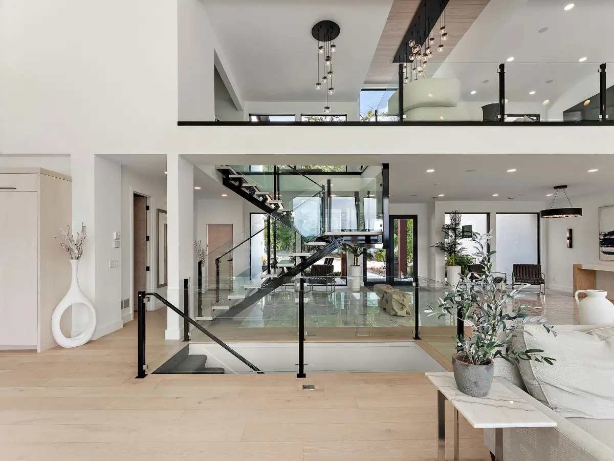
✔ Executive-home photography can emphasize premium kitchens, primary suites, home offices, larger gathering spaces, custom finishes, landscaping and outdoor entertainment areas while maintaining the property’s individual land and neighborhood context.
✔ Country-home photography can establish how the residence interacts with surrounding acreage, landscaping, open land, wooded areas and privacy rather than presenting a rural property as though it were located on a conventional suburban lot.
✔ 6–60 FAA Part 107 aerial photographs where appropriate can establish residence placement, acreage, agricultural land, wooded areas, driveways, secondary structures and surrounding geography where flight conditions, airspace and regulations permit.
✔ Minnesota River Valley aerial context can help explain elevation, river-corridor geography, wooded bluff relationships and broader terrain where those characteristics genuinely influence an individual listing.
✔ Bluff and elevation photography can document slopes, approaches, elevated building positions and meaningful landscape relationships without implying panoramic views where those views do not actually exist.
✔ River, stream and water-context photography can incorporate relevant geographic relationships where present while clearly distinguishing actual frontage or views from general proximity to Blue Earth County’s extensive water network.
✔ Acreage-property aerial photography can establish how the residence relates to open ground, wooded portions, landscaped areas, agricultural land and supporting structures across larger parcels.
✔ Property-boundary highlighting where appropriate can help buyers interpret multi-acre, irregular or visually complex parcels that cannot be understood easily through ground-level photography alone.
✔ Open-versus-wooded land visualization can distinguish maintained grounds, tree-covered areas, agricultural acreage, natural buffers and other meaningful sections of the property.
✔ Farmstead photography can deliberately present the residence as one component within a larger property system, establishing its relationship with agricultural buildings, yards, fields, storage areas and access routes.
✔ Agricultural-building photography can give barns, machine sheds, storage structures and other relevant improvements dedicated coverage rather than reducing important property infrastructure to distant exterior photographs.
✔ Workshop photography can document entrances, interior working areas, storage capacity and other visible functional characteristics where the building materially contributes to buyer interest.
✔ Multi-structure aerial photography can establish the physical relationship between the residence, detached garages, workshops, barns, agricultural buildings and additional improvements across the parcel.
✔ Building-to-land storytelling can help buyers understand how individual structures interact with yards, fields, wooded areas, driveways, open acreage and the surrounding landscape.
✔ Property-access photography can document entrances, driveways, internal routes and approaches to secondary structures where access contributes materially to rural property functionality.
✔ Agricultural-land context can document the visual relationship between buildings and surrounding farmland where relevant without making unsupported representations regarding productivity, soil quality, tillable acreage or agricultural classification.
✔ Wooded-property photography can emphasize tree coverage, natural screening, residence placement and privacy while aerial perspectives help explain how wooded portions relate to open or improved land.
✔ New-construction photography can document contemporary architecture, builder finishes, completed interiors, exterior materials, lot position and surrounding development across applicable Blue Earth County communities.
✔ Construction-to-completion photography can provide builders and developers with visual documentation extending from active construction through finished residential presentation.
✔ Investment-property photography can document building condition, layout, exterior configuration, land and site context while Matterport and floor-plan assets support preliminary remote evaluation.
✔ Greater Mankato context can help executive, relocation and investment buyers understand how applicable properties relate to the county’s primary regional employment, commercial and service center without relying on unsupported commute-time claims.
✔ Rural-to-regional storytelling can be particularly valuable for properties where acreage, agricultural surroundings or small-community living coexist with practical access to Mankato-area employment, shopping, services and regional infrastructure.
✔ 30–240 second cinematic property films can connect arrival, residence, interiors, acreage, agricultural buildings, wooded areas and relevant river-valley or Greater Mankato context into one continuous Blue Earth County property story.
✔ 15–60 second vertical reels can transform architecture, acreage, aerial land perspectives, workshops, outbuildings and distinctive geographic features into reusable assets for listing launches, social media and real estate professional branding.
✔ FPV walkthroughs can connect residences with garages, workshops, decks, yards and other relevant structures, helping remote buyers experience how complex properties physically function instead of viewing every improvement separately.
✔ Matterport 3D Tours, Zillow 3D Home Tours and 2D & 3D Floor Plans can help buyers understand executive residences, country homes, additions and multi-level residential layouts before traveling to the property.
✔ Twilight photography where appropriate can showcase executive residences, country homes, architectural exteriors, landscaping and outdoor entertainment spaces when evening presentation contributes meaningfully to the listing.
…………………………………………………………………
 Awarded by Quality Business Awards #1 BEST RATED 2025 – Photographer in South St. Paul, MN
Featured by Peerspace Among the Best 9 Photographers in Minneapolis
✔ Fully Insured FAA Part 107 Certified Drone Pilot
✔ One Appointment for Interior, Exterior, Architectural, Aerial, Land & Multi-Structure Coverage Where Appropriate
✔ No Image Limits — We Deliver Every Professionally Edited Photo Needed to Showcase the Complete Property
✔ Executive Residence, Country Home & Acreage Estate Photography
✔ Farmstead, Rural Property & Agricultural Building Coverage
✔ Workshop, Outbuilding & Multi-Structure Property Photography
✔ Property Boundary & Acreage-Scale Visualization Where Appropriate
✔ Minnesota River Valley, Bluff & Elevation Context Where Relevant
✔ River, Stream & Water-Corridor Context Where Applicable
✔ Open-Land, Wooded-Parcel & Building-to-Land Storytelling
✔ New Construction & Construction-to-Completion Photography
✔ Greater Mankato Regional Context Where Applicable
✔ FPV Residence-to-Outbuilding & Property Walkthrough Capabilities
✔ Matterport 3D Tours, Zillow 3D Home Tours & Floor Plan Documentation
✔ 24–48 Hour Photography Turnaround Where Applicable
✔ Serving Blue Earth County, Mankato, Greater Mankato, South-Central Minnesota & Beyond
…………………………………………………………………
A Blue Earth County property should not be marketed as simply another South-Central Minnesota acreage home, executive residence or farmstead. Its distinction can come from the county’s unusual intersection of Minnesota River Valley geography, wooded bluff terrain, hundreds of miles of rivers and waterways, productive agricultural land, rural townships and the economic and residential influence of Greater Mankato.
UAV Vision Media builds the visual strategy around whichever of those relationships actually defines the individual listing using professional HDR and architectural photography, FAA Part 107 aerial media where appropriate, property-boundary highlighting, river-valley and bluff context, agricultural-building documentation, building-to-land visualization, cinematic films, vertical reels, FPV walkthroughs, Matterport 3D Tours and floor plans.
The resulting marketing package helps executive buyers, acreage purchasers, rural-property buyers, farmstead purchasers, relocating households and investors understand not simply what buildings exist on the parcel, but how the residence, land, terrain, agricultural structures, wooded areas, access and regional positioning function together.


