


Charles City real estate has a geographic anchor that changes how properties should be marketed: the Cedar River runs through the community and connects residential areas, downtown, recreation and a long industrial history.
Today, that river relationship includes parks, trails, pedestrian connections and the Riverfront Park WhiteWater Course. For an appropriately located home, buyers may care about genuine river views, outdoor recreation and connections toward downtown. But Charles City is not simply a waterfront market. Established neighborhoods, character homes, acreage properties, rural residences and commercial sites each require a different visual story.
The media strategy also needs to be different from nearby Mason City. Mason City can demand architecture-first photography because of its exceptional Frank Lloyd Wright and Prairie School legacy. Charles City instead requires photography capable of moving between Cedar River context, established housing, recreational riverfront, rural Floyd County acreage and commercial or former industrial geography.
A Charles City property should therefore be photographed around what actually defines it—not forced into a generic North Iowa package.
…………………………………………………………………
Buyers searching for “Charles City IA homes,” “Cedar River homes,” “historic homes in Charles City,” “Floyd County acreage” or commercial property are asking very different questions.
For a character home, buyers may want to see original woodwork, built-ins, staircases, masonry, windows or other architectural details where present.
For a Cedar River-area residence, the important question may be how the home actually relates to the river, parks, trails or downtown—not simply whether a scenic river photo can be added to the listing.
Move outside the compact residential areas and buyers may need to understand acreage, driveway access, outbuildings, tree lines and residence placement.
Commercial buyers need another layer entirely: building frontage, parking, entrances, site circulation, neighboring uses, road access and the property’s relationship with Charles City’s downtown or employment geography.
UAV Vision Media changes the photography, drone, FPV, 3D tour, floor plan and video package according to which of those Charles City buyer questions the property needs to answer.
…………………………………………………………………
Every Charles City assignment is built around the property’s actual relationship with architecture, river, downtown, land or commercial site—not a generic North Iowa shot list.
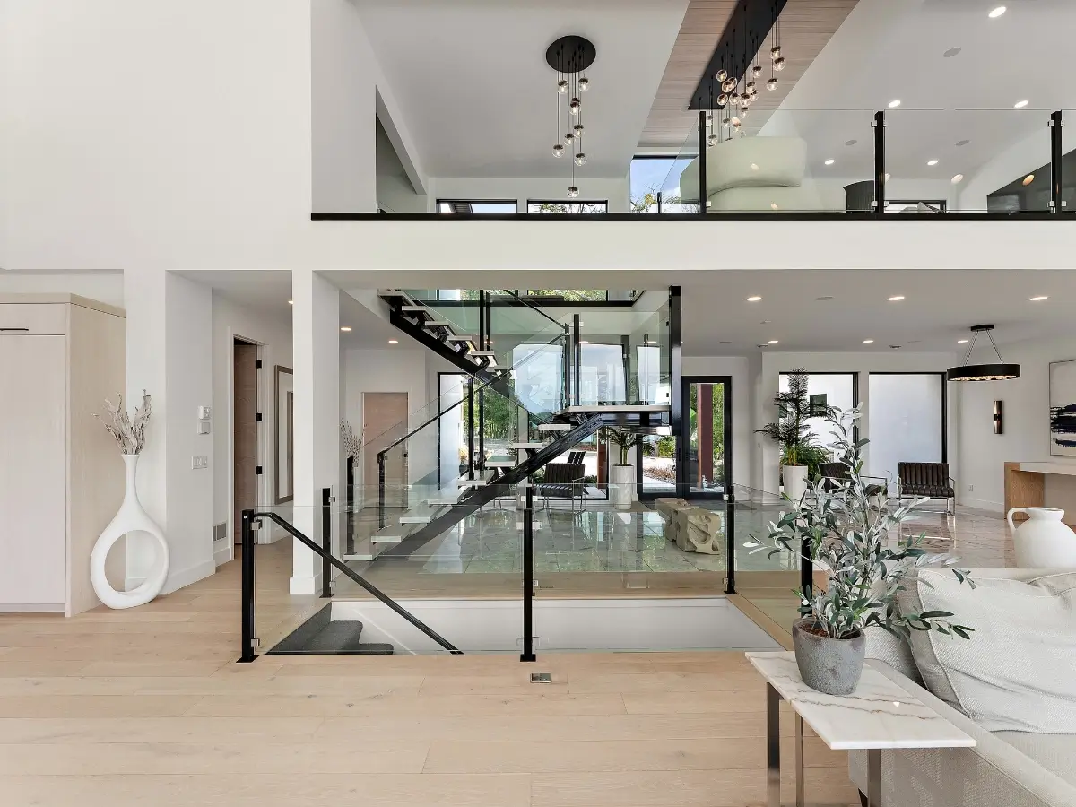
✔ 20–200 professional HDR real estate photos can document interiors, exterior architecture, yards, commercial spaces and the property features buyers actually need to evaluate.
✔ Cedar River context can be incorporated where genuinely relevant without implying river frontage, views or direct access that the property does not have.
✔ River-view photography where present can connect actual Cedar River views with windows, decks, yards and outdoor-living areas.
✔ FAA Part 107 drone photography where legally and operationally appropriate can establish a property’s relationship with the Cedar River corridor, surrounding streets, downtown or larger parcel.
✔ Riverfront-orientation aerials can help buyers understand where an applicable property sits relative to water, streets, parks and surrounding development.
✔ Riverfront Park WhiteWater Course context can support appropriately located properties where recreational proximity genuinely contributes to the location story.
✔ Park and trail context can be incorporated where relevant without representing public amenities as private property features.
✔ Downtown-connected properties can receive wider location coverage when walkability or proximity to Charles City’s commercial core materially contributes to the listing.
✔ Historic and character-home photography can preserve room proportions while highlighting genuine architectural details.
✔ Woodwork photography can document trim, built-ins, cabinetry, staircases and other craftsmanship where present.
✔ Masonry and fireplace photography can give distinctive construction details dedicated coverage rather than allowing them to disappear inside wide room photographs.
✔ Established-home photography can balance character with the practical features buyers search for—kitchens, bedrooms, bathrooms, storage, garages and usable yards.
✔ 2D & 3D Floor Plans can help explain older homes with additions, multiple levels or less-conventional layouts.
✔ Matterport 3D Tours can help remote buyers explore the residence before traveling to Charles City.
✔ Zillow 3D Home Tours provide another interactive option for applicable residential properties.
✔ Larger-lot photography can establish residence placement, usable yard, vegetation and surrounding space.
✔ Acreage aerials can show how the residence, driveway, outbuildings, open land and tree lines relate to one another.
✔ Outbuilding photography can document barns, workshops, pole buildings, detached garages and storage structures where they contribute to the property.
✔ Property-boundary highlighting where appropriate can help buyers interpret larger parcels when reliable boundary information is available.
✔ Rural-residence photography can combine interiors with land, access and privacy rather than marketing the property as simply a house outside town.
✔ Commercial exterior photography can document façade, entrances, signage areas, loading or customer-access points and overall building condition.
✔ Commercial interior photography can show retail, office, industrial or mixed-use space according to how the property actually functions.
✔ Commercial-site aerials can establish parking, access, building footprint, neighboring development and road relationships that ground photography cannot explain efficiently.
✔ Charles City’s tractor-manufacturing heritage can provide relevant community or commercial context where appropriate without turning unrelated residential listings into history pages.
✔ 30–240 second cinematic property films can connect arrival, architecture, interiors, river or downtown context, acreage or commercial site features into one coherent property story.
✔ 15–60 second vertical real estate reels can highlight river views, character details, remodeled interiors, acreage, commercial frontage or other high-impact selling points.
✔ FPV walkthroughs can connect interior spaces, multiple levels and suitable exterior areas where continuous movement helps explain the property.
✔ Outdoor-living photography can showcase porches, decks, patios, yards and gathering areas where they contribute to residential livability.
✔ Twilight photography can strengthen character homes, executive residences, commercial exteriors and properties with attractive exterior lighting.
✔ Property websites can combine professional photography, drone imagery, cinematic video, FPV, 3D tours, floor plans and verified property information into one dedicated presentation.
…………………………………………………………………
 Awarded by Quality Business Awards BEST RATED 2025 – Photographer
Featured by Peerspace Among the Best 9 Photographers in Minneapolis
✔ Fully Insured FAA Part 107 Certified Drone Pilot
✔ One Coordinated Production for Interior, Exterior, Architectural, Aerial & Site Coverage Where Appropriate
✔ No Image Limits — We Deliver Every Professionally Edited Photo Needed to Showcase the Complete Property
✔ Charles City Residential & Character-Home Photography
✔ Cedar River-Area Property Photography Where Relevant
✔ Historic Architectural Detail Photography
✔ Floyd County Acreage & Rural Property Photography
✔ Large-Lot, Outbuilding & Property-Scale Visualization
✔ Commercial Real Estate & Site Photography
✔ FAA Part 107 Drone Photography Where Appropriate
✔ FPV Property Walkthroughs
✔ Matterport 3D Tours, Zillow 3D Home Tours Where Applicable & Floor Plans
✔ Cinematic Property Films, Vertical Reels & Twilight Photography
✔ Property Websites & Multi-Platform Listing Media
✔ 24–48 Hour Photography Turnaround Where Applicable
✔ Serving Charles City, Floyd County & North Iowa
…………………………………………………………………
A Charles City listing should not be marketed as a Mason City property with a different city name.
Mason City can require architecture-first photography centered on Prairie School design, Frank Lloyd Wright context, art glass, masonry and integrated craftsmanship. Charles City requires a different visual hierarchy. Here, the Cedar River can connect residential property with parks, recreation and downtown, while the surrounding market expands into Floyd County acreage and commercial property.
The media changes again within Charles City itself. A Cedar River-area home may benefit from river-orientation photography and carefully selected aerials. A character residence may need close architectural-detail coverage and floor-plan clarity. An acreage property needs drone imagery connecting the house, driveway, outbuildings and land. A commercial property may need façade, parking, road access, site circulation and downtown or industrial context.
Charles City’s identity adds another layer that cannot be copied into neighboring pages: the Cedar River as the community’s geographic spine, Riverfront Park WhiteWater Course and a manufacturing history tied to Hart-Parr and the development of the American tractor industry.
UAV Vision Media builds the photography, FAA Part 107 drone, FPV, cinematic video, Matterport, floor plan, architectural-detail, commercial-site, twilight and property-website package around that exact Charles City property—showing buyers how the residence or building actually relates to the Cedar River, downtown, land and wider Floyd County setting.


